Gmaps Pedometer mashup!!
31 maj 2006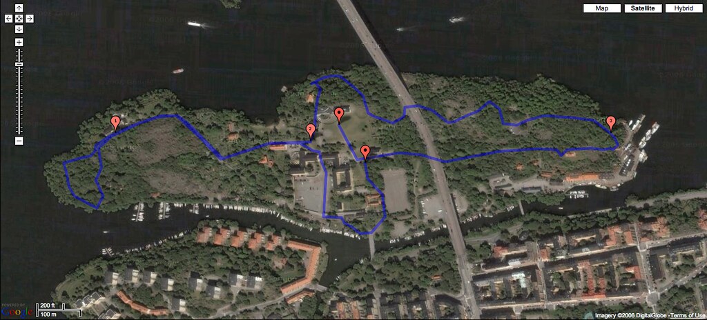
Today I found the best google maps mashup ever! It’s called Gmaps Pedometer and is a sie for tracking your movements/runs/hikes/whatever, using Google Maps API.
I just had to try it after after todays orienteering race Stockholm City Cup (actually my first in like 10 years) which took place on Långholmen, walking distance from my house. The numbers on the map is the distance run! Also on the Gmap Pedometer you can see how much calories you’ve burned (not so useful), and if the area has elevation data you can get a graph showing every points hight level. Unfourtunately, there are no height data for my town (Stockholm).
After doing the tracking I decided to put some time later this summer on combinding real orienteering maps with the Google API and the Gmap Pedometer site. We’ll see how that goes.
[…] pedometer and is a sie for tracking your movements/runs/hikes/whatever, using Google Maps API. …http://www.oskarlin.com/2006/05/31/gmaps-pedometer-mashup/No elevation on gmap-pedometer.com?No elevation on gmap-pedometer.com? rec.bicycles.misc. Visit our […]
/gmap pedometer com 2008-06-22, 07:46
[…] Lngholmen Nationalmuseum Nordiska Kompaniet Norrmalm Royal Dramatic Theatre …oskarlin Blog Archive Gmaps Pedometer mashup!!It’s called Gmaps Pedometer and is a sie for tracking your movements/runs/hikes/whatever, … years) […]
/långholmen 2010-03-28, 01:56
Lngholmen Nationalmuseum Nordiska Kompaniet Norrmalm Royal Dramatic Theatre …oskarlin Blog Archive Gmaps Pedometer mashup!!It’s called Gmaps Pedometer and is a sie for tracking your movements/runs/hikes/whatever, … years
/Louis Vuitton Mini Pochette Accessoires 2010-10-14, 02:52
Very cool stuff! Thanks, kepp going on!
/ugg shoes 2010-12-29, 06:40